 Drab Makyo - Madison Scott-Clary
Furry Survey - Location Data
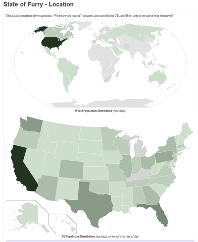
The latest addition to the Furry Survey visualization series is two choropleth maps that show population density of respondents, not only across the world, but also within the densest country, the US. Rather than relying on maps, the data was used to style SVGs and then converted into PNGs.